This is my current thinking for the storm later this week, and let me tell you something... It will catch a lot of people off guard. Yes it is December 5th but if we take a review of the past few weeks we find unseasonably warm weather, with our last snow back in October! The other big thing of course is the local weather stations, and even the major weather stations. They will not pick up on the storm until at least later tomorrow. It's just how they work. In fact, they may never pick up on it. If we review the October snowstorm, the forecast a few days before was rain with temperatures in the 50's in the tristate with maybe a chance of backend snow. Next day it was maybe a coating or an inch for the coast, and 3-6 inches inland. Then the next day was the actual day of the storm, and all the professionals are scrabbling to get last minute forecasts out of 12+ inches... Hopefully I've made my point
Models are beginning to come to a consensus. The outliers are the NAM and CMC. The NAM is rather warm and further west with only an inch or two for the major cities, while the CMC is OTS and showing no snow for anyone. Then we have models like the Euro and GFS who are in between. If we take a consensus track, it looks pretty darn good with a track close to the benchmark.
Based off all the latest, this is what I see right now in terms of snowfall...

I see a widespread swath of 3-6 inches just off to the north and west of the big cities. The hotspots will be across the WV and VA mountains where I can see up to 10 inches of snow, and then another hotspot from northern NJ through CT and into MA. I can see these totals fluctuating both up and down, which is why the map is so likely to change come tomorrow.
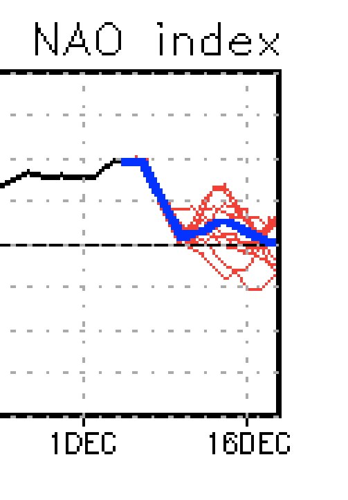
Interestingly enough, we get the teleconnections in favor. NAO goes neutral to negative, AO does the same, and PNA goes positive, all around the time of the storm.


The other big thing, something I always talk about, is consistency and trending. We have seen both of those. We're seeing all the models trending toward one another to a track favorable for decent snowfall on or near the I-95 corridor. We've seen the GFS move further and further west towards a more favorable solution, and we've seen the Euro trend further east towards a more favorable solution. We're also noticing that models are jumping like they were a few days ago, and becoming more consistent. These are good signs folks.
I'm excited to see what the overnight models show. Right now it looks like if I were to change my snowfall map, it would be to up the totals. BUT, for now expect 1-3 inches of snow for the major cities, and not too far inland expect more then 3 inches with isolated amounts up to 10 inches.

Remember you can always check out my facebook page "Wild about Weather" for more updates! Enjoy!