Search This Blog

Sunday, February 28, 2010

Noon Update... Snow threat map.... Quake and Tsunami....Westport weather...

Weather Forecast:
Part 1: Finally snow map is ready...
Part 2: Update on Quake and Tsunami...(must see)
Part 3: Westport Weather...

Part 1:

Finally my computer has decided to cooperate with me so here's the snow map for the next 2 snowstorms...

First storm (monday-wednesday)...


Second storm (Tuesday-Thursday)...


Part 2:

All tsunami warnings have been lifted... It seems little damage was done anywhere away from the south America area by the tsunami... As for the earthquake... over 300 are now dead and as i said before, this next week will probably be the worst for those in Chile... The tsunami hit more destructively on some of the islands off the coast of Chile and even parts of Chile itself... Coincidentally a 4.4 earthquake struck the Oklahoma area yesterday afternoon... No damage was reported except for people being shaken up a bit... Just wanted to talk about how far reaching the chile earthquake was... LA, USA felt sloshing in one of there lakes which is basically like water moving around more rapidly, and they said they felt a bit of shaking about 3 minutes after the Chile earthquake... That's it for now... More update on how Chile is doing and how you can help coming up later...

Part 3:

A good afternoon to everyone in westport... A few sprinkles are being reported across Westport at this time, do not be surprised if there are also some wet snow flakes... The chance for some wet snow and rain will increase as we go toward our evening hours... Tonight expect and rain changing to very light snow and flurries, no accumulation expected... Tomorrow some rain or snow showers are possible throughout the entire day, but not likely, otherwise it will remain cloudy with the high around 40. Tuesday there will be a strong system off to the north where we could see a couple flurries or snow showers with a lot of wind through the morning... Then clearing up for noon time on tuesday just before another system comes in later that day... Tuesday night snow and some rain will become likely... and rain will quickly change to snow tuesday night... Wednesday, i can't make any promises, but kids will have to keep a close eye on this one because if everything comes together we could potentially be talking about some kind of snow day... Thursday we should finally be clearing out... Keep checking back for more updates throughout the day...

- Scott Pecoriello

Saturday, February 27, 2010

Tsunami update... More on potential snowstorm(s)... Westport Weather Update...

Weather Forecast:
Part 1: Tsunami warning lifted for Hawaii...(must see)
Part 2: More snow on the way!!!!
Part 3: More on your Westport Weather...

Part 1:

YES, the tsunami warning for Hawaii was lifted, but not before 4 tsunami waves hit the island... None doing any reported damage to any of the Islands... I have been keeping a very close eye on this, in fact i was watching a live web cam and saw no waves ever hit... So these 4 waves were probably more like 4 times that the water raised 2-4 feet... Some up to 7 feet. I would not be surprised if some very minor damage was done to areas close to the beach. Now some may be thinking how stupid that was that they made everyone evacuate, but it really wasn't. First of all it was a good drill in case something were to happen in the near future and second it was better to be safe than sorry... I was extremely happy to hear Hawaii missed the brunt of this... As for the Chile area, the death toll is rising quickly and they had tsunami impact there... The death toll is right around 214 people as of now... But is rising quickly... Some say the toll could reach 500+ people. Sadly for these people in Chile the worst may be yet to come... Now people are without food, clothing, and shelter, so it may only be a matter of time before people can not live without these essential needs. As for the tsunami wave it looks like Asia, New Zealand, and Japan are in for potential tsunami waves... Same goes for Alaska... Do not be thinking just because Hawaii missed the brunt others will as well because that is not the cause... Hawaii happened to go through a thinner part of the wave, but there may be waves much higher so watch out and continue to check the blog for more on this devastating situation that is unfolding.

Part 2:

Yes i did say i would make a snow map potential for the next 2 snowstorms, but unfortunately my computer is not doing what it should be so i will have to postpone that until tomorrow. For now i can tell you that with the first storm Boston and to the north will have to worry about some heavy snow and lots of wind... snow could locally reach a foot adding to the 2-4 feet of snow already on the ground... The second storm i can say that from Nashville to northern NC to Virginia all the way to Baltimore, DC, NYC and Boston will see at least some kind of snowfall... Areas already very weary from the record falling snow... This seems to be another potentially monster snowstorm... That's really all i can say about these storms so far... snowfall wise for the second storm there will be a swath of snow of at least 6-12 inches... Where that swath is remains uncertain at this time.

Part 3:

A good evening to all the people in Westport! It was very strange what went on today... The high only reached around 34 or 35, yet we had an excessive snow melt... In fact so much melted i was able to see the tops of the grass! It was impossible to tell just how much snow fell, but i assume around 10 inches or less... No snow actually fell today which was a bit surprising... Tonight expect just some clouds... As for tomorrow we will be watching that coastal storm or Nor'easter which is expected to give a good snow to our north... Right now it seems we could see some snow showers and flurries tomorrow into tomorrow night... Monday looks to be a good day with clouds changing quickly to some sun... With the snow tomorrow we could see maybe a coating to an inch of snow at most... Wednesday is still getting interesting... I would consider this your first warning because it seems that we may have another snowstorm on our way! I will be certain to keep you updated!


-Scott Pecoriello

Update on everything...

Weather Forecast:
Part 1: Tsunami on its way...(must see)
Part 2: Northeast Region Update...
Part 3: Westport Weather Update...

Part 1:

Over 82 people are officially dead from the earthquake that was an magnitude 8.8 which struck just off the coast of Chile around 3 AM this morning... If you think about it, this earthquake is 500X stronger than the Haiti earthquake which left thousands dead... This is going to be different for 2 reasons... 1 is that the general Chile area has much stronger structures, even though there have been reports of building collapses we do not expect it to be as bad as the Haiti area... Sadly, i would think, the worst is yet to come for the Chile area because now its about finding food and water and shelter. Unfortunately that death toll will likely increase and in a hurry. 2, i think its better that the worst of the quake did not hit a major city... There have been at least 25 after shocks and at least one of those were equivalent to the Haiti earthquake... This is the 5Th strongest Earthquake ever recorded in the word... This is not even the worst part of the whole situation though... I am much more worried about the tsunami part of this... It seems this quake has unleashed a nasty tsunami that may strike the Hawaii area... It is possible that this will be devastating... The tsunami is expected to hit the area at around 11:15 AM Hawaii time... 4:15 NYC time... Its not just Hawaii i am worried about though... It seems the whole west coast of the U.S. will experience at least a water rise, if not they may experience some form of a tsunami... Mexico and Alaska are included in this... Now i am beginning to worry about New Zealand and Japan... Even parts of Asia... There is no telling how large these waves are going to be, but we must prepare for the worst.

Part 2:

The noaa radar shows this snowicane really well here... what its basically is these really small squalls of snow across MA... Within these squalls we're finding these very quick but dangerous 1-3 inches of snow... Now across eastern NY there is more of a steady, more together snow that is moderate to even heavy at times... Albany is in the think of this reporting some moderate to heavy snow... In this steadier more together snow don't be surprised if you see 2-4 locally 5 inches... This snow is extending through Albany and now beginning to creep south and circulate around this low into the poughkipsee area... What i am beginning to see is this snow moving south and seems like it will eventually go from SW to S to SE and maybe even E eventually... If that were to happen, we would have to watch the tri-state area for the potential for snow, which is in the forecast today. In fact as it moves south it seems to be strengthening so this is something that is beginning to concern me. Across Maine we are actually beginning to find very thin and very heavy bands of snow dropping quick 2-4 inches of snow off the Atlantic ocean... Some of this will mix in with rain. Also heavy snow off the lakes in NY state and into the PA area as it begins to shift southward... I think the radar, though, is on to something very important and areas like southern New England and NYC... If all goes right maybe 1-3 inches could fall with this. As for Sunday and Monday, i am growing concerned with a storm that will come off the coast of FL and then hook back in toward the Maine coast and really bomb out producing some heavy snow for many of the area that were hit with 1-2 feet of snow... We'll have to see if this really affects the i-95 corridor... Then again another snowstorm may affect the i-95 corridor Tuesday into Wednesday...

Part 3:

As mentioned in the part 2, i am beginning to see snow creeping southward and eventually southeastward which could give us flurries and snow showers that may amount anywhere from nothing to a coating to 3 inches if everything comes together... Otherwise expect lots of clouds and some sun today with a high of around 35. I am also becoming more concerned with a coastal storm that will be coming out to sea from FL and then hook back into the north of us in the Sunday Monday time frame... It looks like right now some more heavy snow could fall to the north of us, but here maybe more snow showers and flurries for Sunday and Monday with small accumulations... And another storm that looks like it has a better chance to give us decent snow, Wednesday... Stay tuned here and I'll keep you updated...

Noaa radar...

Another Day another snowstorm... and what about the snow totals?... More from our Snowicane?... And some very scary world wide news...

Weather Forecast:
Part 1: Snowicane Update...
Part 2: Some of the totals
Part 3: More snow on the way!?
Part 4: Westport Weather
Part 5: The wildest Weather Location...(must see)
Part 1

Off the accuweather.com site...


Well our snowicane is really weak and is continuing to weaken as the morning goes on... NYC, this has been officially the snowiest month on record in over 100 years! Baltimore has had officially over 80 inches of snow this winter season... This shows just how powerful not only this February was, but also this one single storm... Monroe, NY picked up 3 feet of snow! Even my home town, which had all rain on Thursday, picked up around 10 inches of snow... Now what else is going on with the "snowicane" right now? Well its still spinning over the extreme eastern portion of Long Island and as a said before... It's weakening very quickly. Never the less, we are still finding moderate banding across the northern CT areas, all of MA, most of eastern NY, and even scattered snow showers into PA... These will continue to spin clockwise and become more scattered... They're so scattered that there is a very good chance that every area north of the Virginia area should see at least some flurries... In these moderate banding's, do not be surprised if you see 1-3 maybe 2-4 quick inches of snow... Also do not be surprised if all of a sudden the sun comes out like it is currently doing in my home town. According to the satellite radar imagery, this is just a short gap that should shortly go over to either some clouds or flurries... As this storm weakens, it is actually spreading its moisture... The storm is now officially spreading its moisture over 1,900 miles! Snow from just west of Chicago all the way to the middle of the Atlantic Ocean, from a low that is just to the WNW of Long island... We will continue to see this spreading of moisture and clouds and snow showers and spinning and 1-3, 2-4 inches all the way until Monday!!!! This storm is a very slow mover... Sadly it seems Tuesday will be our only day of snow before the possibility of another snowstorm!!!...

Part 2

Here are just some of the totals off the Weather Channel...


Atlantic City: 7.6 inches
Newark : 14.5 inches
Philadelphia : 5.6 inches
NYC : 20.9 inches
Monroe : 32 inches
Goshen : 29.4 inches
Tuxedo : 29 inches
middletown : 28 inches
Greenville : 22.5 inches
Ringwood : 19.3 inches
Allentown : 12.4 inches
Colts neck : 13 inches
West Milford : 28 inches
Kane : 8.1 inches
Buffalo : 3.2 inches
Pocono Summit: 19 inches
State College: 3 inches
Exton : 10.1 inches
Stamford : 36 inches
Laporte : 12 inches
Syracuse : 14.4 inches
Binghamton : 16.5 inches
Rochester : 11.9 inches

More should be coming in as the day progresses...

Part 3

Yes, the big question is... Is there more snow on the way?... Well the answer to that is YES... Now the details are still coming in on this storm, but as of snow it seems it has a better chance of hitting the mid-Atlantic states... So North Carolina, Virginia, Into DC and Baltimore this may be your storm... Yes, according to Henry Margusity, this may be another BIG DADDY! That would add to the 80+ inches we have had in Baltimore!!!! I will be posting a snow threat map, which means I'm just going to show where the potential for light snow, moderate snow, and heavy snow... No snowfall map yet! My 12:00 PM update will have the much more detail on this upcoming snowstorm...

Part 4

Westport Weather...

Map of Westport, CT


A good Saturday to everyone, i hope you are all enjoying the snow we had and may still have to come... I have yet to go outside and measure just how much snow has fallen in the Westport, CT area... i am assuming it is between 8 and 10 inches of snow... maybe more, maybe less... There is a good chance that we find some flurries later today and into tonight... This storm is pretty much just circulating off the coast of Long island just to the West which means snow is still circulating around this storm...
The snow right now is off to the north, east, south, and west, so we are kind of in a small break... even the clouds are breaking across Westport, so do not be surprised if when you wake up this morning you see the sun outside... sadly i believe that the sun will slowly begin to become covered by clouds again. We may not see it again until Tuesday since there will be the threat of at least some flurries over the next 2 or 3 days... After that we get set up for the NEXT STORM... This storm will happen between maybe after midnight on Tuesday into before sunrise on Thursday... So just a heads up for those of you who have plans on Wednesday... For now it seems this storm will stay far enough to our south that we will only see a couple snow showers with some light winds and small accumulations... Now if the storm can get its act together we may have a different story... We may actually have the threat for school problems on Wednesday whether its a delay, cancel, or early dismissal i will be sure to keep you updated! That's it for now... enjoy the snow!!!!

5 day forecast:

Today: Scattered flurries and snow showers with occasional sun, and breaks in the clouds... The high will be right around 35 with very light winds.
Tonight: Scattered snow showers but a better chance of snow. low 27. Little or no accumulation

Tomorrow: Scattered snow flurries becoming less and less likely as we progress through the day. High 40. Little or no accumulation.
Night: snow showers becoming less likely toward morning... Low 28

Monday: Snow showers early... windy... Sun may come out in the afternoon... High 43... Snow may begin to now slowly melt.
Night: clouds decrease and winds lighten up... Low 30.

Tuesday: Partly cloudy with clouds slowly increasing toward the afternoon hours... High 42... Winds light.
night: Cloudy... light snow may begin well after Midnight and into the next morning... Low 30

Wednesday: Potential for coastal storm... for now it looks like only some snow showers or flurries, but that may change... High 37
Night: Still the potential for snow.. low 29.

That's it for now... stay tuned for more Westport Weather...


Part 5:

BREAKING NEWS: WARNING: Very sad news that Chile has reported an 8.8 magnitude earthquake... One of the highest every recorded in history... a couple hundred people have sadly been reported dead... If you think about it, this is 500X stronger than the Haiti earthquake... The good news is that Chile has much stronger structures, never the less, there have been many aftershocks already... The really very scary news is that tsunami reports have already happened around the Chile Area, but, these watches and warnings go all the way up the Mexico western border line and now into the California and Oregon area... Watches and warnings have also been posted across the Alaska area and Hawaii... This is very scary and real. They say sometime between 4:00 PM and 4:30 PM we could potentially have a major tsunami in Hawaii... Please be very careful in those areas... Some even more scary news is there have been reports of sloshing across the Gulf of Mexico and into parts of the Atlantic ocean... We will have to see what happens... Keep it here for much more updates...

Tsunami watches and warnings off the weather.com site...


- Scott Pecoriello

Friday, February 26, 2010

Westport Weather Update...

Westport Weather Update:

Currently as of around 11:00 PM the general westport area is approaching 10 inches of snow... I believe this is now the biggest snowstorm of the season!
Some light snow is currently falling and will continue to do so into tomorrow and tomorrow night, and even into sunday and monday!!!! But it will all be flurries and a couple of snow showers... Total snow by monday morning for Westport, CT will be right around 1 foot of snow... Again, these will be scattered snow flurries and snow showers over the next couple of days so you may have slightly more or less than 1 foot of snow by monday morning where all snow should stop... And we may see the sun!!!! Now it seems that unfortunatley, ANOTHER SNOWSTORM IS POSSIBLE!!!! This will take place sometime between wednesday and thursday! We will keep you update... So from this storm look for an additonal 1-3 inches of snow... The worst, luckily seems to be over! That's it for now... Look for another update tomorrow morning!

Do Not Be Fooled...

Weather Forecast:
Part 1: Snowicane Update
Part 2: Westport Update

Part 1:

A lot of dry air is working its way into the center of our storm here which is going to really make this snow very scattered about... Do not be fooled Though!!! There are 2 reasons you shouldn't be fooled by this lack of snow and stormyness... 1 is these smaller pockets of scattered snow are heavy! so if you run into one you could pick up an inch or two very quickly! It will also be blizzard like in these conditons... 2 the models and future casts all point to this storm becoming more active once again and having steadier snow across the area... DC and Baltimore, what ever you have on the ground right now is probably it... I see no more real accumulating snow for your area... Philly its winding down and at least the main part to this storm has left you for good... some bands of very light snow and flurries may leave a coating snow additionally. NYC still snowing but braking up quickly... Again the models and future cast are both pointing to the storm somewhat pulling itself back together... At least enough so that NYC picks up an additional 2-4 inches of snow... By the way i believe around 20 inches of snow are now in NYC, so up to 2 feet is possbile!!!! That's it for now on the storm... Enjoy it

Part 2

Hey everyone... Remember, like i said before, do not be fooled by this. This is a very weird snowstorm, and while you think its over... It pretty far from it... Actually technically speaking we are almost half way through it!!!! Meaning there's a whole other half! Luckily the 2nd half seems to be much less snowy... There will be on and off light snow through this afternoon and into the early evening hours... After that the snow could begin to pick up again into an accumulating snow. Tomorrow you should see light snow throughout the whole day... Yes it will stop, become bright outside, and then start again and go through that pattern the whole day into tomorrow night... Sunday looks like a similiar story too... Again, we are watching a system that should stay well of the coast but could enhance some of that snow just a bit... Enough so we get some more light accumulations and that may very well last into your first half of monday and then FINALLY we may see the sun AGAIN!!!! Its been a long long time! that's it for now... i should have another update around 5 or 6... have a good snowstorm!!!! And incase you were wondering Westport, CT has officially 7 inches of snow!!!!

Late morning Update on the Snowicane...

Today's Weather:
Part 1: Update on the "snowicane"
Part 2: Totals so far
Part 3: Westport Weather

Current Map of the Snowicane

PART 1
OK so the snowstorm is really throwing every bit of energy it has right now so the next 1-3 maybe 2-4 hours will likely be the worst of this snow... After that it will be all light to moderate and every once in a while a heavier band of snow may work its way in... NYC has announced that they haven't seen the kind of snow for over a decade now... Its still snowing hard and they already have a foot and a half of heavy wet snow, which kills Weather.Com's and Accuweather.Com's forecast for NYC which called for 6-12 at most... The area that's going to get hit the worst is the area just to the North and West of the city... This includes suffern, monsey, Newark, greenwood lake, Newburgh and areas just north west of there where there is a good chance of 3 feet of snow! right now those areas are approaching 2 feet and with all this left over snow that looks like its going to last for days, we could see an additional foot! MA is now in the think of the snow, but mostly western MA... NY state is seeing the worst from this storm and areas in upstate NY will likely reach 2 feet by time all is set and done. The farther to the east you go in PA the more accumulations you are likely to see, with the exceptions of the mountains where you may pick up a foot of snow... NJ is also being slammed by this snowstorm... The heaviest of the storm, again, will last at most 5 hours and then begin to kill itself over the land areas... It will continue to spin itself and just spit snow everywhere it can... Reports of snow in DC and Baltimore have come out... up to 2-4 inches of snow could hit Baltimore... As for D.C. i think the most they'll get it 1-3, probably less...There is a very heavy band of snow and wind kind of hanging over the Southwestern CT area and into Long Island that is almost stationary at this point... These areas are picking up 1-3 inches per hour!!! These are the same areas that got 2 or more inches of rain, so they are not pretty much making up for all of it with this heavy wet snow... Earlier on an eye like feature was taking place with this storm, which is very odd, so it really is hurricane like...

Part 2
Not too much of an update on the snowfall totals other than NYC with almost 20 inches!!! Monsey and monroe and Newburgh all have around 15-20 inches now and Binghamton is more than 20 now so we shall see how these all turn out...

Part 3

Some excited news for those of you that are looking outside and wondering just how much snow we got... As of 11:00 AM we have about 6 inches of snow... Now for those of you that are not impressed with this snowfall, keep in mind that its snowing right now at about 2 inches per hour and that could last another 3 or 4 hours!!!! So if you can do the math, that means an addition 6-8 inches is possible + the 6 inches on the ground... That's a 12-14 inch snow total!!!! Which is currently my forecast for the Westport District area... Now if these snow bands can stay together longer than expected don't be surprised if you see 18 inches of snow like in NYC... If they don't hold together we could still have 8-10 inches which is not bad... The biggest snowstorm we've gotten this year was the one i titled "blizzard #2" which hit right before February brake where we get around 9 inches of snow... As of now there is an 85% chance we will be braking that record, making this the biggest snowstorm of the season!!!! I'll keep you updated as often as possible... The 5 day forecast has not changed much, but here it is...

Friday : Snow and windy... 2-4 inches of snow expected High: 32
night : Snow and windy... 1-3 inches of snow expected Low : 30

Saturday : A.M. Snow changing to snow showers...1-2 in. High: 38
night : scattered snow showers... little accumulation.Low : 30

Sunday : scattered snow showers... Little accumulation.High: 40
night : May be a coastal storm... (something to watch)Low : 32

Monday : May be a coastal storm... (something to watch)High: 41
night : Finally clearing out ... chilly... Low : 27

Tuesday : Partly cloudy with sun peaking through often..High: 44
night : Partly to mostly cloudy... turning colder... Low : 30

Early Morning Update on Snowicane...

Today's Weather...
Part 1: Snowicane has begun...
Part 2: More storms to come?!?!?
Part 3: Westport Weather...(school closings, forecasts, and more!)


Well yes it has started, and even here in southwestern CT it looks like we have somewhere between 2 and 4 inches of snow and that will continue... Across NJ, NY, and Northeastern PA, we already have more than 20 inches in a lot of areas and we could find and additional 3-5... maybe 6 or 7 inches in some spots... Now as you get into MA conditions will improve significantly, especially during the morning hours... Once you get into the afternoon hours and into tonight you will see some light to moderate snow and snowfall, after being hit pretty hard by rain... The Snow in MA will primarily fall the further away you get from the coast or the east... VT and NH, you are in a dry air spot right now, or a lull... You had a lot of rain yesterday, and now it will change to some scattered snow and snow showers with some accumulations, especially as you make your way to the north and east...

Current radar image of the snowicane...


Along the Maine coast it will continue to be rain for a while before finally mixing with some light snow... little or no accumulation will take place in coastal Maine... As for inland Maine, someone could get an easy foot. Yes, i still think someone will reach 3 feet in the central and southern NY area and maybe even NE PA... The Low is located about 50-100 miles due North of NYC... You will find across the southern New England area (Stamford, Westport, Bridgeport, New haven) we will have a short lull in the action before it starts to pick up again... This is Because that area is going from the front to the back side of this storm system. NYC schools have been officially closed to today, which wasn't a surprise considering 10+ inches have already fallen and another 5 or 6+ could still fall... Across Staten Island its a similiar story where you are just being battered by a real true blizzard! Now for a while this monster snowicane has been our main topic... So if you would believe it, there are actually 2 more possible systems that could bring us wintry weather this week and next week!!!...

The first possibility for another wintry storm is on Sunday night into Monday... This first system, the snowicane, will still be bringing some scattered snow showers and flurries, so this storm Sunday into Monday will only increase the snow showers and flurries... If you remember the current system, the snowicane, it increased the precip. in the very first system, so this may happen again but hopefully not nearly as bad... It also looks the storm may be too far off the coast to give anyone anything significant...

Here are some of the snow totals out of the tri-state area:

Washingtonville: 25.5 inches
Harriman : 23.2 inches
Mountain lodge : 22 inches
Goshen : 21.3 inches
Middletown : 21 inches
Craigville : 20.2 inches
Warwick : 19 inches
Mount Hope : 18.7 inches
Florida : 17 inches
NYC : 16.9 inches!
Roselle : 15.8 inches
Vails Gate : 15.3 inches
Suffern : 15 inches
College point : 14 inches
Grennville : 14 inches
Bedford park : 14 inches
Newburgh : 14 inches


The second possibility is the Wednesday into Thursday time period where again, a storm will be just off the coast... Models are pretty much going back and fourth between showing a major system impacting the Northeast and showing the storm being too far off the coast...

That's it for now... It's only 6:00 AM, so when the sun finally rises i will be sure to keep you updated on the conditions... Enjoy the snowstorm! and remember, there may be more to come...

LOCALIZED WESTPORT, CT:

Winter storm Warning issued yesterday evening for Westport, CT...


Well a good morning to everyone in Westport, CT... Kids, you got your wish because as expected the Westport School District has closed all public schools! So today most will be staying home, and that may be a wise decision... As your waking up, it will probably look like most of the snow is over... The sky will be cloudy but fairly bright, and no snow will really be falling besides some flurries, but you will notice we picked up anywhere from 2-4 inches of the white stuff... Well that will certainly change as we get toward mid to late morning... This is where we will find moderate to even some heavy snow throughout the afternoon and into the evening hours... Expect and additional 3-7 inches of snow from this storm... This will bring us a total of somewhere between 5-12 inches of snow, some scattered locations may have up to 15 inches... Now keep in mind, we could still find light accumulations into Saturday and even sunday, which would up the totals. What's currently going on is we are switching from one side of the storm to the other, and in this process we will see a couple hours of no snow and no wind... But again, that will change... Now it is very possible we are finding flurries and snow showers from this storm all the way into Monday... In fact its likely at this point... This storm will just sit and spin and pretty much stall around our area... So the next 3-4 days will feel like we're in Antarctica... With this storm also expect blowing and drifting snows... Now, tomorrow in Westport there are a lot of activities... The morning activities maybe the ones that are cancelled... Now notice how i said maybe. I cannot be sure they will be cancelled because it matters how much its snowing tomorrow morning... At this point, i am leaning toward anything before the noon time period being cancelled but those are only my thoughts... Now for the next several days:

Friday : Snow and windy... 2-4 inches of snow expected High: 32
night : Snow and windy... 1-3 inches of snow expected Low : 30

Saturday : A.M. Snow changing to snow showers...1-2 in. High: 38
night : scattered snow showers... little accumulation.Low : 30

Sunday : scattered snow showers... Little accumulation.High: 40
night : May be a coastal storm... (something to watch)Low : 32

Monday : May be a coastal storm... (something to watch)High: 41
night : Finally clearing out ... chilly... Low : 27

Tuesday : Partly cloudy with sun peaking through often..High: 44
night : Partly to mostly cloudy... turning colder... Low : 30

Thursday, February 25, 2010

Frustrating rain snow line and what most of you are probably thinking about this storm...

Hey everyone, Pretty much the same drill as last night... This storm ended up packing more warm air for SW CT than i thought... With that said NYC got colder air then expected... Its been snowing since early this morning across the NYC area but yet we only have around 2 inches of snow on the ground... Why you ask?... Well that is because this is a heavy wet and slushy snow, so we won't have very much sticking until maybe closer to the midnight time... Expect and addition 5-8 inches of snow tonight on top of your 2 inches and then light additional accumulations for quite some days to come which may mean we get a good amount over a foot of snow... I'm talking somewhere between 10 and 15 inches like i talked about yesterday... For SW CT though, since that warmer air did come in, I'm lowering the snow totals to a foot at most... now depending where these heavier bands of snow set up over the next couple of days from the slowly weakening low, may make a difference in who get what... There is still the chance we get 10-15 inches from the left over snow... NW NJ, NE PA, and SE NY have had snow all day and much more to come... Keep in mind this storm has yet to really explode into a "snowicane"!!!! Here's the New snowfall forecast and some more information on this SNOWICANE!!!!....

NYC : 10-15 inches
Westport : 8-12 inches
Philly : 6-10 inches
Binghamton : 18-24 inches
Boston : RAIN
Hartford : 2-4 inches
Monsey : 14-20 inches
Scranton : 14-20 inches
Pittsburgh : 3-5 inches
Cleveland : 7-11 inches
State college: 4-7 inches
Buffalo : 5-8 inches
Burlington : 1-3 inches
Caribou : 7-14 inches
Portland : RAIN (snow will eventually come weekend into next week)

Now i am sure a lot of you across Connecticut woke up this morning, and thought we were all crazy about a monster blizzard on its way... Well trust me... This blizzard will come... It may not be as bad as off to your north and west but it will certainly drop some good snow across the area and wind with it... Right now the low is located just south of Long Island, and as we speak it is strengthening and meeting up with out low that was in the Midwest earlier... I am already seeing some really good banding going on.... With that said we are going to go localized........

LOCAL WEATHER:

Hello to everyone in Westport CT... I am sure you are having a nasty and rainy day... but the snow is on its way! The snow amounts may be so localized that i have to split up Westport in small districts... It seems if you are to the west of the Saugatuck River you may see around 1 foot of snow... To the east of The river we will be talking about more of a 6-10 snowfall... All the kids in the Westport School District... LISTEN UP... My current forecast is we will see a change over to mixed precipitation at around 8 PM... All snow by around 10 or 11 PM, and it will be wet... The good accumulating snow will start AFTER midnight... The worst of the storm will be from 12 AM - 10 AM... In that time space we could see snow coming down at 1-2 inches per hour... Now you may be thinking... Oh shucks, only a delay:(... But that is not the case... It is likely when you wake up you will have anywhere from 3-5 inches and maybe up to a half a foot of snow across the Westport area... It will still be snow at a good rate and by time the schools Open, You will all have 6-8 inches of snow and it will still be snowing! This to me seems like we should have school closed for the Westport School District For Tomorrow... Now, in the event the rain does not change to snow until midnight or after, it would be a very hard call... VERY!!!! This is because, in this case, you would wake up with 2-4 inches in the area and then the snow would lighten up a bit... But as the afternoon progresses i expect snow to become moderate to heavy again... So a delay would not work... and neither would an early dismissal, because that would only be sending kids home in bad conditions. So it seems i have come to the conclusion that we are probably going to have no school tomorrow... This does not mean to not do you homework, but i wouldn't count on going to school tomorrow... That's it for now... Enjoy your snowstorm...
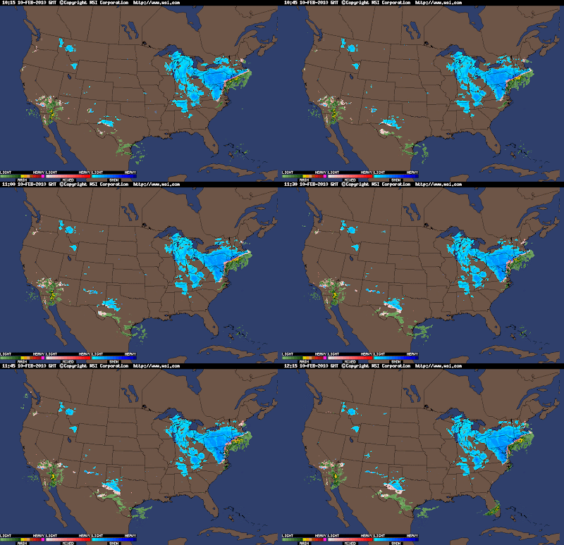

Intellicast 5:30 PM radar..."Snowicane"...

Wednesday, February 24, 2010

SNOWICANE... Too much hype yesterday? New information today?

WOWEEE! We have quite a storm headed our way... The moisture has already made it to the Virginia area, meanwhile the low is all the way in Florida! So as you can see that already shows quite a storm. And yes i am calling it a snowicane! While things have changed from yesterdays blog, this storm will still have hurrican force wind, rain, and even Precipitation! I will say this now, that some will pick up 3 feet of snow as mentioned yesterday! The toughest and quite frankly most annoying forecast is the tri-state area... The chance is there for all the tri-state area to see 1-2 locally 3 feet of snow... The chance of seeing a split in the tri-state area, where the western side get 1'-2' locally 3' and eastern side gets 3"-6" locally 8", is also there and at this point a little bit more likely... But there's much more to it! I do have a snow map right now... i feel 60% confidence with this snow map, which is not very high in confidence for me... The chances of this changing seem to be more like 80-90%%! Even if they are slight changes... so here it is...

Snow Map...


For those of you that can not read a map like this here are the predicted totals:

NYC : 10-15 inches
Philly : 6-10 inches
Baltimore : 4-8 inches
Washington D.C.: 3-5 inches
Hartford : 4-8 inches
New london : coating
Islip : 4-8 inches
Staten Island : 10-15 inches
Westport : 10-15 inches
Monsey : 12-18 inches
Pittsburgh : 4-8 inches
Buffalo : 8-16 inches
Binghamton : 16-20+ inches
Boston : 0 inches, Rain
Scranton : 10-15 inches
Cleveland : 3-5 inches
...

There are a lot I am not adding in, especially New England but hopefully you can read the map well enough!

Now to a bit of a new subject... THE WIND... Hurricane Force Gusts are possible!!!! Where the wind will be the worst is across the Northwestern PA area, Southeastern New York and parts of Northern NJ...

Now the way it looks now is very interesting and rare! This may be one of those storms that you will never see again, or at least not for a while! The storm is going to make at least one loop and then stall for a while... While stalling, it may make some small loops... Either way it will be very interesting! This stalling will allow the heavy wet snow to just sit over the areas for days and days and have wind whipping the general northeast area as it slowly moves away. Now let's get a little more specific...

My forecast is for this low to take the snowier track... others have NYC in 4-8 inch snowfall... some 3-6... some 8-14... mine is 10-15! I do believe this storm will have warm air moving in from the atlantic but this storm is so powerful i do not believe that warm air will get all the way into NYC... I think it will warm up... and we will have rain mixing... But where the storm is 50% snow, 50% rain... I say 90% snow, and 10% rain. Again i could be wrong... A 5 mile shift could mean a lot... either way...

So that's it for now... I'll keep you updated, especially when the new model run comes out later on... That's it for now... Enjoy your snowricane!!!!!

Tuesday, February 23, 2010

BIGGEST, BADEST, AND SCARIEST BLIZZARD OF THE 09-010 SEASON

I AM GIVING YOU A WARNING RIGHT NOW THAT ANYWHERE FROM PHILLY TO BRIDGEPORT TO ALBANY TO AGUSTA AND WEST OF THERE UNTIL ABOUT THE BUFFALO AREA WILL SEE A PARALYZING BLIZZARD!!!!! flights from late wednsday to friday will be cancelled... this is the equivelent to a category 1 HURRICANE!!!! Winds will gust up to 80 mph!!! Someone will easily pick up 30 inches of snow... MAYBE MORE... Think about this... 30 inches of snow and 80 mph wind gusts... This will make more history... As if we didn't have enough record setting snowstorms! i just looked at the GFS model and it was freaking out on this snowstorm... Now Boston, Portland, the Cape, all of New hampshire, and the surrounding areas will see what seems to be an actually hurricane... 3+ inches of rain will fall with 30-40 foot waves and winds gusting past 80 mph!!! I am going to talk about my home town area for just a second because it seems you will be bombed away by this storm... i see, as of now, 2-3 feet of snow... 70 mph winds... and the area will pretty much be shut down... NYC similiar forecast... Roads will be closed... Schools closed for weeks... Yes NYC may have school closed twice for the first time in a long time... maybe the first time ever... but im not sure about that... Philly seems like the same story... with the exception of probably only 8-14 inches... WHICH IS STILL NOT GOOD! I can not express just how crazy this storm is. Albany 1-2 feet of snow. Rochester over 1 foot of snow. Were things get the most crazy though is the coast of MAINE! You will see heavy rain, thunderstorms, wind gusts past 80 mph... after a certain amount of time, which remains on know as of right now, this hurricane will change over to 20 inches of heavy wet snow and winds gusting even higher with 40 foot waves! Did i mention this is THE BIGGEST SNOWSTORM OF THE SEASON!!!! This is just going to burry cities in feet of snow! TAKE THIS WARNING NOW AND DO NOT... DO NOT GO OUT ANYWHERE ON THURSDAY OR FRIDAY UNLESS ITS AN ABSOLUTE EMERGENCY!!!!!! as for DC and Baltimore... looks like a miss for this one... maybe some flakes... if you're lucky you'll see a coating to 2 inches... PA you'll see an extreme cut off! Western PA may not have more than a couple snow flakes while Eastern and Northeastn sections of PA may see a foot of snow! Accuweather and weather.com MUST get their act together because they do not see that NYC and suburbs barely to the North and East... My house... Will get the BULLS EYE FROM THIS INSANE, PARALYZING, MONSTER, HURRICANE, BLIZZARD STORM!!!!!!

GFS model shows BLIZZARD...

Monday, February 22, 2010

IMPORTANT NEWS ABOUT STORM # 1

It seems the possibility, which was introduced to me about an hour ago, of storm #1 shifting to a southern track is becoming more likely as the night goes on... this is going to be a very quick update, so I'm just going to post two maps... one of the northern track and the other of the southern track.

More northerly track...


More southerly track...


So the more likely of the two is track #1... But of course... I am going against the odds, i think track #2 has just as good as a chance especially because the current radar is favoring track #2...

1,2 punch? 1,2,3 punch? 1, 2, 3, 4 punch? How many more????

Well i cannot say how many more storms we have to go through until we see flowers bluming, but i can say that we will at least have a 1,2,3 punch... maybe more. So lets brake down these 3 storms for you

Storm 1: right now is affecting the great lakes and working its way into Upstate NY and PA... This will be an all rain event for Washington and Baltimore... Philly you will see rain to start with maybe some sleet pelets... but NO accumulations... As for NYC, you will see rain to a mix tonight, tomorrow should be a mix to rain... i could see a coating to 1 inch in the NYC area... The southern suberbs like Staten Island should see maybe an icy coating from this at most... Now as we go into southern New England i could see 1-3 along the coast and as you make your way more inland you could see 3-6... Boston expect 1-3 inches of snow... Now for the starting times... DC- late afternoon today... Baltimore- late afternoon... Philadelphia- Mid-Early evening... NYC- Mid-Late evening... Hartford- Late evening... Boston- Overnight... Now to find the major snow you have to go to upstate NY where someone will pick up 12-18 inches of snow... we will see blizzard conditions at time, especially in western NY. Maine, most of you will see 6-12 inches. Here's the map of conditions for this first storm...


Storm 2: This is a weird one because you will not be able to tell the difference between #1 and #2... It will rain or snow or wintry mix for probably 4 or 5 days straight, but they are really 2 different storms... looking at the models the 2nd storm looks to be worse than the 1st because it has colder air with it so the i-95 corridor could see 4-8... maybe 8-12 inches the further north you go... This storm will be a weird one also because it seems it will do a double loop... I'll show you what i mean...


Storm 3: This may be the pattern changer and it looks like it may happen sometime between the 3rd and the 9th... This looks like a monster right now from The carolinas right up to maine... it looks like a possible pattern changer which we've been looking for for a while now. It also looks like it may be another 2-3 + foot blizzard... Here's my map so you can compare all 3!!!!.... again this storm is really far away so it may not be too accurate...


Thats it for now... enjoy the weather while you can!

Sunday, February 21, 2010

Everything has gone crazy... snow, rain, and big storms on the way?

Well yes, everything has gone pretty much crazy! I do not believe the models really know what they are doing because 2 days ago they showed a blizzard... Yesterday they showed a smaller, weaker storm that was drawing warm air with it... Today it shows a storm tracking close to the coast with the rain snow line directly over NYC with burst of heavy precip. across the immediate tri-state area... It also shows a giant burst of very, very heavy precip. once the low gets to long island... This burst shows more than a foot of snow... easily. Now i do not want to leave out DC, Baltimore and Philly... Nor do i want to leave out New England... so here's the scoop...
You're going to get 6-12 inches all across New England from this first storm... Now this storm will also bring lake enhancement and Lake effect snow, so someone in that area could see 2 feet of snow by time all is set and done... This is nothing too exciting though, just some lake effect snow that you are used to seeing... Where it gets interesting is that this lake effect snow seems to keep up from Tuesday(when the storm starts) into late Wednesday(when the storm ends) and all the way into possibly Friday and Saturday... and it will go all the way to the coast... so don't be surprised if it snows almost everyday in some places...
Now for the Mid-Atlantic... It seems to me this is going to be a chilly rain... moderate at times... snow will be melting... this is where we are faced with an issue... some of you still have 1-2 feet of snow on the ground... this rain can lead to a number of problems: flooding, roof collapse, and most importantly... ICE... this flooding + the cold air that is behind this storm will = a lot of ice issues... I wouldn't be surprised if things had to be shut down again! I do think this storm will end though, with a band of snow. I'm going to say... i still think you guys have Winter left, as you could tell from my last posts... Now i am going to do a daring thing... i have decided to make a snow map!!!! This is going to be crazy because all the models are all over the place, so i tried to put everything together... Remember, this may be not accurate at all... but it also may be completely right!


You can see that my bulls eye zone is just north of NYC to just north of the Berkshire county, and in between... so NYC, Hartford, Springfield, and Albany can get 8+ inches out of this one... Keep in mind, this is not including the lake effect snow!!!!

That's it for now... expect another update this afternoon!

Saturday, February 20, 2010

Quick Update on the 1, 2 Punch

Hey everyone... Since i have a flight to catch later today i will only have time for a quick update...

1st Punch: Storm will spread a swath of snow from Chicago to Cleveland to Albany to Portland and North... expect anywhere from 6-12, 12-18 inches of snow in these areas... Now from Pittsburgh to Philly to Boston we will see snow to mix to snow... expect 4-8 inches in these areas... south of there there will be a mix to rain to mix with around 1-3 inches or less... A change in the track could easily raise and lower these snow totals in your area.

2nd Punch: Storm will first hit the TX area and through the Arizona and NM area with heavy snow... similiar to there last storm... Totals at this point are too hard to say... The storm will take a break in the Mid-Sections of the country and then re-strengthen along the Northeastern Coast... This storm has a good chance to be another Blizzard with 2-3 feets of snow and wind... The catch is this area will be much further north than the past blizzards... It seems I-80 and North will see the bulk of this blizzard... As the storm gets closer we should have more details...

Friday, February 19, 2010

Most agree this is not your average winter event...

Even Accuweathers Joe Bastardi agrees this kind of winter event does not usually happen... The current situation we are looking at is pretty much the kind of situations you'd see 30-50+ years ago... In fact this kind of event is becoming un heard of... If I had to make my best guess I would say today marks the halfway point in our 2009-2010 winter season, which is pretty scarey. I would not be suprised if this winter lasted into April for a lot of people... Yes, Joe Bastardi predicted this winter fairly well but, I think he was even shocked by it... So we know of at least 2 or 3 potentially major snow storms to hit the southern areas of the U.S.... With that said, lets get started..,

This is a WARNING for the following areas: Amarillo, Dallas, Oklahoma city, Little Rock, Montgomery, Birmingham, Atlanta, Raliegh, Memphis, DC, Baltimore, Philly, NYC, Chicago, Indianapolis, Cinncinatti, St. Louis, Pittsburgh, Scranton, Boston, Portland, Bangor, Caribou, Burlington, Syracuse, Albany, Buffalo, and any areas nearby those cities... I would like to officially warn you because everything that those cities have experienced so far this winter, they will likely experience again for the rest of februrary and into march... Now that is with the exception of Raliegh, D.C., Baltimore, and Philly... Their warning is for something else... Their warning is for Flooding and Ice... The track for the rest of the winter seems to be more to the north, so yes they may see some snow but it looks like a lot of rain and ice is in store on top of the 2-4 feet of snow already on the ground... This may mean travel delays, School closures, and much more complication(this is when it ices)... They also will experience flooding(this is when it rains) For the rest of you a lot of snow and Ice and the same old same old will be in store... Take this warning as a gift and act now!

I will have another update sometime tomorrow... I am leaving FL, so i should be home right in time for the crazy action to start... The update tomorrow will include much more detail on the expected back to back snowstorms Next Week!!!!

Annoying, complicated, and big storm on the way...

Yes it looks like the possibility of this snowstorm early next week is becoming more likely, but some annoying and complicated details seem they are to come with this storm...

As of now it seems the big cities will see some light snow, then a wintry mix and some rain, and then ending as snow... These cities include Washington, D.C., Baltimore, and Philadelphia... Where it gets complicated is NYC, Hartford, and Boston... This is where it may be all snow, or a wintry mix like the rest of the cities... This could be the difference of several inches(if there is a wintry mix) or 6+ inches(all snow)... I was able to narrow down the time frame of the storm, but not by much... The storm will impact the major cities between late Monday and into late wednsday... That's all for now... Check back later!

Thursday, February 18, 2010

Short break in snowstorms is finally over... Winter to resumed again

Well as you can see from the title this winter, in my perspective, is far from over... In fact for some... The worst is yet to come. Today my forecast is going to be based off what I've heard about this upcoming storm, the gfs weather models, my knowledge about weather, and of course... My gut feeling. So lets get started...

First off, keep in mind that I have not had access to the best resources since about 9:00 AM... Meaning this information will likely change which is why I will update again later tonight... Secondly this storm is definitely going to happen in the Northeast/mid-atlantic states between the time frame of late Sunday (the earliest) and early Thursday(the latest)... Now do not freak out, this is not a 50 hour snowstorm!!! This is simply just a time frame of when the storm may hit... So we'll leave it as an early/ mid week snowstorm. Thirdly the potential is there for this to be another major blizzard... This is the storm I've been talking about for a good week now, and how this may change the pattern... Well I've come to a decision that this storm will not change the pattern... That does not mean it won't be strong, but if u look to the weeks ahead on the models, it is clear that for many it will stay cold and snowy... And, as mentioned before, the worst of this cold and snowy weather is yet to come... Bottom line is this is a storm to watch carefully across the Northeast and Mid-Atlantic around the early to mid week time space!!!!

Tuesday, February 16, 2010

The Weather Channel catches on... But what about Accuweather?...

Yes finally The Weather channel, who was very close to my forecast yesterday, has changed their forecast so it matches mine almost exact... I'm going to show you there map from yesterday and there map for today and then i'm going to show you my map, and you will be able to see just how close they are...

Weather Channels map from yesterday...


Weather Channels map for today...


My Snow map from yesterday...


Now keep in mind these are ADDITIONAL accumulations, meaning that areas like NYC that show 1-3 inches of snow have already picked up 1-3 inches of snow, so their totals will be in the 2-6 inche range so thats why on my map they are in the 4-8 inch range... As you can see my map and todays weather channel snow map, are very similiar... Now if only Accuweather could change... Im not going to show you Accuweathers map, but you are welcome to go on their site... Trust me, i love accuweather, but this storm just isn't theirs... Now onto the NEXT STORM!!!!

It seems we have yet another clipper system which seems like it is going to give most of its snow to the virginia area... so nothing too exciting there because it seems to be moving fairly quick and does not have much strength, so there will be very light accumulations with this storm...

Now i would like to talk about Henry Margusity's blog from Accuweather... I believe he is on to something here... He is predicting an end of the month snowstorm or more like a big daddy... He says this storm will be so big and powerful it may change this cold and snowy pattern!!!! This may be one of those 2-3 foot snowstorms with winds up to 70 mph!!!! Now i see nothing on the GFS, but like Henry says, I think the GFS just doesn't know exactly how to handle this storm... As for the Euopian model, its a whole different story... This shows a very good storm right off the coast of NJ bringing heavy snow and winds to the Mid-Atlantic and Northeast... so this is obviously something to watch...

That is it for now... Another update coming this afternoon and evening...

Monday, February 15, 2010

More Mistakes...

I disagree almost completely with Accuweather which rarely happens... In fact i think The Weather Channel may be much closer with this storm... let me show you both snow maps...


I wish i could put the GFS model on here as well but it doesn't seem like i can so I'll just try to explain what is happening... As you can see the Accuweather snow map shows a strip of around 10 inches of snow stretching from extreme western MA, through the extreme south eastern section of VT, right across Central and Northern NH, and right through the central part of ME... I have almost no idea how Accuweather came up with this map... i see no models following or supporting there idea. Everything that it shows west of Central PA looks to have had around 75% already fallen... a lot of lake effect snow is now coming on the back side of this storm... This is some really intense lake effect snow and it is extending all the way into areas as far south as southern Alabama, Mississippi, and now even into Georgia... This is such a lake effect snow event that i think it won't have too much trouble getting past the Appalachian mountains... In fact it will likely make it all the way to the coast for several days after the clipper system moves by, so that is something we should watch over the next couple of days... Now something very interesting which both of the snow maps have is this lull of dry air in the middle of this storm which will really lower accumulations across Central, and southwestern PA, so it seems that is out rip off zone with this storm... in those areas we still may see 1-3 inches of snow... Now where it gets tricky is across New York, Connecticut, Rhode Island, MA, VT, NH, and ME... so pretty much the New England area... It seems the GFS, Weather Channel, and Accuweather, are all in a bit of a fight. As a explain before Accuweather is more for a Northern New England Snowstorm while The Weather Channel is more for an East Coast of New England kind of snowstorm... The third party decider would be the GFS which is much closer to The Weather Channel, except for one thing... It shows Central NJ, Long island, CT, Rhode Island, southern VT, and southern NH get the bulk of this storm... This is pretty close to The Weather Channel... It seems though, even though I love this site, that Accuweather is in La La Land with this one... So to put all of these together i decided to make my own snow map...


That's it for now... we will see what happens with this storm tomorrow!!!!... if you are expected to get snow, ENJOY IT!!!!

Saturday, February 13, 2010

Looking like a good snow for some... A monster snowstorms is coming later...

Hey everybody... The high in fort Myers today was only 59 degrees today... Opposed to an average of around 75 degrees... I know what those of you who live in the northeast and mid-Atlantic states are thinking... I should be very happy because some of you may barely reach freezing today... For the most part I'm happy, but the wind makes it feel closer to around 49 for a high today, even though those of you in the northeast and mid- Atlantic would even take 49 for a high but I can say with confidence that 49 degrees won't happen for a very long time... In fact it will probably only get colder for you. As for you in Florida we should have a slow warm up where temperatures may get close to 70 degrees until about Tuesday where a weak cold front will come through and move temperatures back into the lower 60s and unfortunately some of you may get back into the upper 50s... The good news is the sun will be out for at least the next week with maybe some rain on Tuesday as the front comes through, and the wind will really calm down so at dome points it may feel 5 or 10 degrees warmer then the actual temperature...after the cold front on Tuesday it looks like another cold front will take place late Saturday and into Sunday but before that some of you may hit 80 in southern Florida ahead of the cool front... Everyday this week until Saturday I will have this kind of intro with the weather in Florida!!!! Now to the snowy news...

A clipper system will drop through the Midwest giving most people 1-3 inches with locally 4 or 5 inches and then as you make your way toward Ohio and into west Virginia you will see somewhere around 3-6 inches with locally 8 or 9 inches... Now once you get into southeastern PA and into DC, Baltimore and up toward NYC and Boston you will see anywhere from 6-9 with locally a foot as this storm looks to strengthen once reaching the Atlantic ocean... Remember SE PA includes Philly... So it seems the I-95 corridor will once again get hit by a snowstorm... Keep in mind that this is not a blizzard with 1-2 locally 3 feet... We will see though some heavy snow with a little wind, especially as the storm begins to strengthen over sea...

Now this clipper is the 6th major snowstorm to hit the eastern 3rd of the country.. And it seems we have spotted a 7th and believe it or not this may be the most powerful of all the storms which is absolutely insane considering the last 2 storms have dropped anywhere from 2-3 1/2 feet of snow with winds close to hurricane force... So u can only imagine what this storm may hold ... Thats it for now... I'll update around 10 tonight!

Potential blizzard again

http://www.accuweather.com/radar-regional.asp?level=regional&type=sir&site=NE

yes it looks like another potential blizzard for the Northeast and mid-Atlantic states...

Friday, February 12, 2010

Goodbye Snow... Hello Sun... and for some Hello to the snow... AGAIN!!!! The south is in for it too!!!!
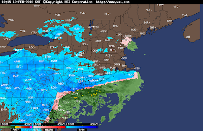
By the title you may think the snow is finally going to go away in the North East and Mid-atlantic...... But, NO... The reason that is my title is because I am in FLORIDA!!!... Nice, sunny and warm Florida... but no, Florida today is rainy and cold and far from nice... A cold front is currently coming through and it looks like parts of Northern Florida will be in the upper 30's and lower 40's!!!! In fact snow has actually been reported in parts of the Florida Panhandle!!!! In the mid-sections of Florida it looks like we will have temperatures in the mid to lower 50's and in the extreme souther parts of Florida you may barely reach 60! Really just yucky around here... but better then a foot of snow and winds making it feel like the -0's!
Yes that will be the case... The Northeast and Mid-Atlantic will see freezing temps and MORE SNOW!!!! and possibly a lot of it! Get this... Parts of the Mid-Atlantic may see 100 inches of snow before the end of feburary... and by march, who knows, we may be aprouching well over 100 inches!!!! Plus the average for most of these places are around 18 inches!!!! That would be more then 80 inches above Normal Snowfall!!!!


We are talking about the potential for the 5th or 6th major SNOWSTORM in the Mid-atlantic/Northeast!!!! I was just looking at previous blogs and saw 4 or 5 other snowstorms that slammed the East!!! This one looks to take the same exact path!!! The potential for 6-12+ inches is again there for you people from Roanoke to Boston... So i do not want to talk to much on this subject because its a little to far right now... even though this storm should hit monday and tuesday... but still. Today i would like our main focus to be on the SOUTHERN SNOWSTORM!!!!

This Winter is just insane and will be remember likely forever!!!! Dallas, TX: Almost a foot of snow!!!! You rarely ever see a foot of snow in Dallas... Snowfall accumulations reported all the way to mobile, MS which hasn't happened since the mid 1900's!!!! I said earlier that snowfall was even reported in the Florida Panhandle!!! Birmingham, Montgomery, and Atlanta saw anywhere from 3-6 even 7 or 8 inches!!! Heavy snow hit all of those areas and now is moving into SC and NC which could all see another 3-6 inches of heavy wet snowfall! That's it for now... I may update again later tonight on the Eastern Snowstorm!!!.....


Wednesday, February 10, 2010

9:30 PM EST Update... snow still coming down..... And HARD.....

It is 9:30 PM and just a quick update here on the snow... It seems more of an unexpected kind of thing going on right now... Heavy snow and wind and still blizzard like conditons are still going on as of 9:30 and BLIZZARD CONDITIONS will last it looks like till 11:00 PM EST along southern New England and NYC... This does NOT include philly, DC, and Baltimore... But it does include Westport, Hartford, Providence and Boston which i believe will see another 3-6 inches!!! Blizzard conditons should end around 11:00 but still light to moderate snow is possible till 1:00 or 2:00 AM... All snow should end by 5:00 AM in southern New england... Though Blowing and drifting snow will last into late thursday which may lead to school delays and cancellations across the area, plus as temperatures drop the snow on roads will begin to freeze in place and areas will look like Antartica! Some totals as of right now are...:

Westport: 12 inches (still snowing)
NYC: 9 inches (still snowing)
Great kills: 15 inches (still snowing)
Philly: 14 inches (flurrying)
DC: 10.5 inches (Snow is for the most part done)
Baltimore: 19 inches!(Snow for the most part is done)
Fanwood, NJ: 16.5 inches
Yonkers: 12.2
Orient : 11.5
Greenwich: 10
Parkchester: 9.4
Perkasie: 19.8!
Ewing: 17.5
Hillsborough: 15
East brunswick: 13
Edison: 10.5
Budd Lake: 10


Some crazy and exciting news is that WASHINGTON, D.C., BALTIMORE, MD and PHILADELPHIA, PA have officially broke the record of the MOST SNOW IN A WINTER with over 70 inches of snow in these areas! and winter is NOT close to over! In fact it looks like another storm may drop several inches of snow monday and tuesday but across the Northeast it may be another monster storm... too early to say exactly what happens. That's it for right now... check back soon!


Current radar still shows monster blizzard...

THE BLIZZARD HAS BEGUN.....

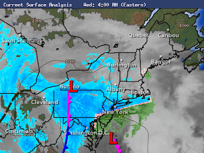
YES, the blizzard has begun right outside my house and across much of the tri-state, mid-atlantic, and even northeast area! But has the blizzard really begun... The answer to that is no!!!! The two low pressures are still seperate and until they come together the true blizzard will not start... you can see those two seperate low trying to come together in the picture below...


Once those two do come together it will bomb off the coast... Blizzard Warnings are currently in affect for NYC, Philly, and DC... i do believe they will extend through the southern New england area, or at least should, and even just south and west of Boston...

Outside currently in Southwestern CT there is some snow definitley picking up in intensity right now and moderate to even heavy... and the real storm hasn't even taken over yet so again 12-24 is still in the forecast for someone around this southern New england NYC, Philly, and NJ area...

That's it for now... very busy today with this monster storm!... ill have another post when things really begin to get crazy... right now there's are 3 inches of snow... another 8-12 is likely!!! Here's a map of the rest that hasn't been explained!...


Tuesday, February 9, 2010

Hey everyone... again i can not express just how excited i am. And if i were to this blog would take an hour to read... so i am not... Lets get right to it.

The snow looks like it has already begun across DC, Baltimore, even Philly! Already a couple inches in those areas... I am a little disappointed again at The Weather Channel. They aren't expressing just how bad its going to be... AND I REPEAT... I AM NOT HYPING!!!! This is going to be another HISTORICAL storm... A monster blizzard... in fact Accuweather.com has clearly expressed that this storm in a lot of ways will be worse then the last one. First off, its a week day! School is already cancelled all over SW CT... NYC closed this afternoon!!!! not heard of!!!! DC is closing for the 3rd day in a row... Some kids haven't had school for 6 days now!!!! 6!!!! that's crazy, but keep in mind this is including the weekend. But still! I would not be surprised if schools were closed again in SW CT Thursday and maybe even Friday and I'll tell you why, but first my other 2 reasons why this is worst. It will be impacting The entire Midwest and a good portion of the southern of the Northeast and once again the mid- Atlantic... so much more space is being covered by this storm. Plus this could be a foot or two on top of the already two or three feet already on the ground. And finally reason 3 is... just the blizzard is going to be 2 times worse then the storm before even if we don't get 3 1/5 feet of snow... someone could easily see 2 feet of snow plus severe blowing and drifting snow for 2-3 maybe more DAYS!!!! With the last storm it was much it was a wetter, heavier snow which couldn't blow until the end of the storm of the storm, and it was only 2 or 3 inches blowing... this is 1-2 feet blowing (it will be a very hard storm to measure). It will be a true blizzard!!!

So now the reason why i think that some schools could be closed through Friday is because of the mad blowing and drifting snow which will be around for 2-3 days! So just wanted mention that, so kids, get excited if you live in southern New England, Southeastern NY, and Northeastern NJ... This is all including long island and also i almost forgot eastern PA... Now let's talk about, annoying, Philadelphia...

OK, here's the deal, i am truly jealous of Philly... First Storm: 28 inches! Second storm: another 10-20 inches is possible so a total of 48 inches(4 feet of snow) is possible by thursday! so we shall see. I'm going to focus on 2 more cities today... One being Philly which i just did, the 2nd being NYC, and the final one being boston!

NYC my forecast is for around 10-20 inches... I am really pushing this possible 20 inches of snow... and possibly 24 inches!!! I think a full out blizzard is in store for NYC... Now the important thing to note is snow may begin to fall in the next hour but will not be steady until probably 8,9, maybe even 10 O'clock A.M. where the snow will become very heavy along with winds gusting past 40 mph, and maybe even close to, or past, 50 mph!!!! so 1-2 feet of snow... 50 mph winds.... and drifts possibly close to 4 or 5 + feet!!!! BLIZZARD OF 2010!!!!

Now to Boston, which i feel bad hasn't really been discussed much throughout this storm, and even throughout the winter... which is wrong... and that is because a foot of snow is possible in Boston by friday... Winds up to 50 mph are possible... and blowing and drifting snow... so why isn't boston being mentioned? well i think it is because 6-10 (locally 12) is possible... and that's not the highest snowfall possible... so i think that since Boston isn't going to get 24 inches of snow, The Weather Channel has decided not to pay attention to them... wrong decision, because come time for the storm to blow up along the coast, it's going to be a full blown blizzard!!!! so Watch out

Now to conclude... We are having a monster blizzard, and probably one that will be put in the record books... now to talk bulls eye, or the target!!! I believe this area will be from Northeastern Philly, through central and Northern NJ, and and then clip eastern PA, and finally i think the NYC, Long Island, Southern New England area will be slammed... and before i'm done, this is very important, SLEET and even rain may become a problem and reduce some total for Philly, Baltimore, and DC!!! so look for that... Below is a map that i created and i believe these are our snow totals... for those of you that can not read the map, don't worry, i made some typed up totals... By the way, Flights are already being cancelled for thursday around the Tri-State area, so check for flight issues!!!! that's it for now... Plenty more updates in the Next 24-48 hours! have a great SNOW DAY!!!! Enjoy the map, and potential totals!!!!


This is in affect through friday afternoon...


Snow Totals(keep in mind these are predictions, look at the ranges more!):

NYC : 12-18(24) inches... 20 inches
Philly : 12-18(24) inches... 18 inches
Hartford : 12-18(24) inches... 16 inches
Berkshires: 6-10(12) inches... 7.5 inches
Concord : 2-4(6) inches... 5 inches
Boston : 6-10(12) inches... 10 inches
Trenton : 12-18(24) inches... 18 inches
Baltimore : Northern Side: 6-10(12) Southern Side: 2-4(6)
DC : Northern Side: 6-10(12) Southern Side: 2-4(6)
Monsey : 12-18 inches... 14 inches
Scranton : 6-10(12) inches... 8 inches
Chatham : 2-4(6) inches... 5 inches (lots of mix possible)
Long island area: Western area: 12-18(24)...15 inches Mid area: 6-10(12)...7 inches Eastern Area: 2-4(6) 5.5 inches

Have a good rest of the day!

Monday, February 8, 2010

Blizzard of 0'10 # 2.... Bigger, Better, and Stronger?

HEY EVERYBODY!!!! I am beyond excited today and im sure you can guess why from the title. Yes, Blizzard of 0'10 #2.... Bigger, Better, and Stronger? This looks to be another monster snowstorm... We could be talking again another 1-2 feet + of snow in some spots. Tonight im going to talk about where the heaviest snow is going to be, including some predictions of totals, and also just how heavy it will be. I'm also going to talk about what this snow is going to cause and the impact!!!!....

So here are my current predictions for the snowstorm!!!! keep in mind these may change come tomorrow...

Chicago : 14 inches
Detriot : 9.5 inches
Indianapolis: 8.5 inches
Columbus : 11 inches
Cleveland : 8 inches
Grand Rapids: 12 inches
Buffalo : 2 inches
Pittsburgh : 8 inches
Lexington : 5 inches
Louiville : 5 inches
Buckhannon : 10 inches
Richmond : 1.5 inches
Roanoke : 5 inches
DC : 14 inches ( on top of 3 feet already on the ground!)
Baltimore : 15 inches
Philadelphia: 22 inches
Scranton : 8 inches
Binghamton : 7 inches
NYC : 24 inches
Otis : 7 inches
Concord : 4 inches
Hartford : 14 inches
Boston : 12 inches
Chatham : 6 inches
Portland : 2 inches
Westport : 24 inches

The highest snow amount i could put is 24 but it could exceed that. So watch out in Philly, NYC, Westport, and Hartford where you will see likely 2 feet and winds in excess of 35 mph... A MAJOR BLIZZARD!!!! Drifting and blowing snow will likely impact the area so Thursday and maybe even Friday will be hard on travel... Temps. during this storm will quickly drop to the lower teens with wind chills below zero... since i have to go, i will put up a couple maps from accuweather that should explain the rest... Much more on the storm tomorrow!!!!